
Aerial Real estate photography is a great way when it comes to showcasing a property listing from another perspective. Unlike ground-based photos, since photographers can use some tips to make your room looks even larger, aerial photos can show off authentic and realistic views of the property. Then homebuyers can easily imagine the dimension of the house. By taking advantages of aerial photography, realtors and agents can show potential buyers a variety of details, including:
Encompassing aerial views of the entire property and land
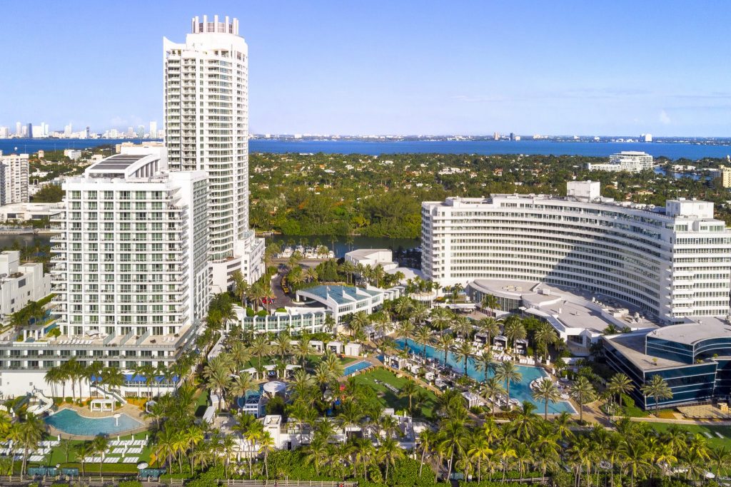
The brand-new perspective with breathtaking views from above is always the thing that can attract homebuyers. Because it can change their way to evaluate the property. By using aerial photos to your marketing materials, you can provide more information about the location and position of the property. For example, some people are finding a house near the center mall or school. Others want to live far from highways, etc. Then showcasing aerial photos is the best way to offer homebuyers the total view of the property and land, and its connection with nature and other amenities. It helps the buyers easy to plan their lifestyle in the future.
Aerial real estate photography showcase the property features that can be difficult to assess

Aerial photos can bring out some of the important details that can be difficult to access. Such as the roof and other features like the balcony with furniture, the garden with a swimming pool, etc. By showcasing your property from above, homebuyers can easy to imagine your property’s dimensions. Then they can consider how suitable it is for their family. For example, they will know how large your garden or the backyard to arrange the things.
What the drive home or the kids’ walk to school looks like
Another important thing is that aerial photos are helpful for their lifestyle. While providing beautiful views of the entire house, it can give the connection between the house with other factors like school or working building. They really want to know how far is it from the house to school or the building so they can arrange a suitable time and the vehicles. Is it suitable for the kids’ walk? Is this safe for them?
The neighborhood and surrounding area, including the home’s proximity to amenities

Compared with traditional photography or ground-based methods, aerial real estate photos are the best way to show up the neighborhood and surrounding areas. It is a crucial thing when it comes to putting your house in a context for homebuyers. All of us want to have a beautiful house with some friendly neighbors. Then it also becomes the key factor when it comes to choosing your future house. Moreover, with the aerial photos from above, buyers can easily know the home’s proximity to amenities.
Property maps and surveys
By using drone photography, realtors can have property maps and surveys to showcase to your customers. It is very important thing to do before they decide to buy this house. This is a useful tool to provide the buyers demographic data, and measure the distance to nearby schools, transit, shopping, hospitals, or other amenities. A property with a great location will be sold faster with higher price. In addition, you have chance to offer the potential customers a great chance to save more time in-person evaluations. They can easily consider if this house is suitable for them or not.